 |
TerrainIllustrated Topics |
The Lay of the Land
All construction happens on the surface of the earth, and no two worksites are the same. Naturally, the lay of the land is often an important consideration when it comes to construction.
Vinci VinTerra™ digital terrain models are custom-made for your construction project. Civil surveys made ideal basis datasets. The DTMs are corrected so that important contextual features like roadways and water features are crowned or dead flat. Retaining walls are modeled and dug into the terrain. Ain’t nothing more bothersome that a DTM that features roads, tennis courts, and creeks on the side of some false hill, especially if you’re planning to excavate there.
VinTerra™ enables convincing depictions of excavation and backfill, sitework, and worksite sections that can clarify tricky conditions to your audience.
Vinci LLC will produce VinTerra™ DTMs for your use! Yes, you can rely on your newbie kids who’ve never been on a jobsite and never designed boring things like retaining walls or parking lots, or you can nip that DTM in the bud with Vinci LLC! Vinci LLC’s scale-assured VinTerra™ models come complete with orthoaerial imagery (location dependent) at resolutions as high as 2 but normally 4-5 inches per pixel. Some VinTerra™ DTMs are simplified to reduce polygons and thereby regen time.
Get acquainted with the lay of the land—get Vinci VinTerra™ DTMs today!
Vinci VinTerra™ Digital Terrain Examples
Here are a dozen examples of terrain in construction visualization. Click on an image below to visit an Example Page. Check out the blue links for further examples or information!
 |
 |
 |
|
Get VinTerra™! Vinci LLC can generate and provide VinTerra™ datasets for your next real estate or AEC project! |
Vinci LLC corrects its digital terrain data so that flat surfaces read as they should—flat! |
Vinci LLC’s VinTerra™ digital terrain models are based on project civil surveys, or the best dataset available |
 |
 |
 |
|
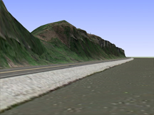
Some worksites demand digital terrain models that are as accurate as is practical |
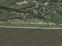
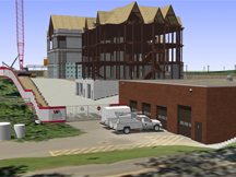
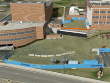
Contextual terrain facilitates excavation visualization and work on hilly construction sites |
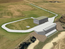
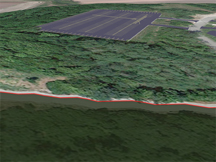
Vinci VinTerra™ is virtually waterproof*! It's ideal for riverine and marine projects |
 |
 |
 |
|
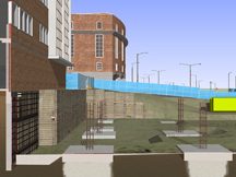
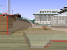
Worksite terrain enables Vinci LLC’s worksite sections. These are ideal for highlighting underpinning and subsurface stratigraphy |
Excavation and infill never were so easy and information-rich as they are with VinTerra™ and Vinci logistics vignettes |
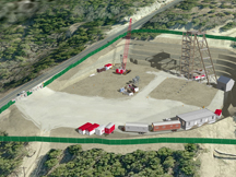
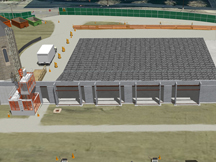
Does your project require regrading the worksite? Vinci VinTerra™ clearly and convincingly portrays the operation |
 |
 |
 |
|
4d Bank retention and excavation sections can be cut as seen fit in Vinci Digital Worksite™ models that include VinTerra™ |
Vinci VinTerra™ incorporates public and project specific datasets. Amendment is sometimes necessary… |
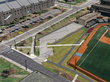
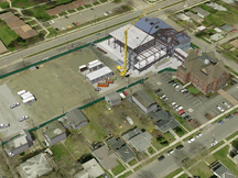
Counterexample: Some worksites are flat or do not engage significant topography. In these cases it’s usually safe to completely ignore terrain variability |
* Please do not pour water on your laptop: virtual terrain is resistant to virtual water.
This page last modified Wednesday 6 August 2014.