 |
k3160Battle Map of Lorilye |
“Battle Map of Lorilye”
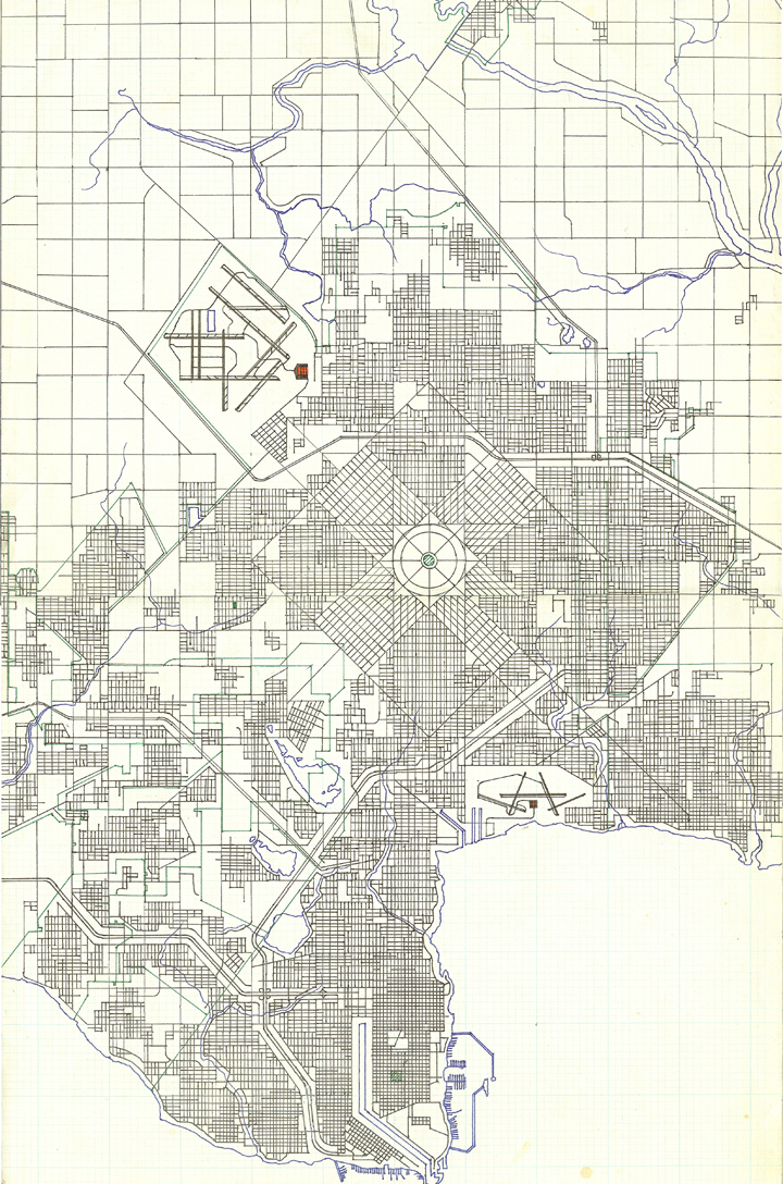
Three close friendships developed in high school, with the artist Dante and two intelligent young men: we developed a game of battling empires that eventually took to the stars. If you’re planning a battle, you’re going to need maps. I produced a wall-size map of my “country”, Lorilei (sic), named after a middle-school crush. The map was produced using a couple dozen tabloid-sized sheets of graph paper. The graph paper, pens, and the USGS inspiration for the effort were purchased at S. G. Adams in the Louis Joliet Mall. This panel is is a proof of concept studying the capital city, Lorilye (depicted in this scene as Loriternal Yev). Over the early summer the map came together, inspiring Dante to produce his own country map. I remember female friends of mine and my sisters identifying a town or city to receive their name. Features of the city borrow from USGS maps, the large airport at the upper left reflecting O'Hare and the seaside airport Glenview NAS in the Chicago area. The port borrows from Chicago Harbor. The actual wall map is lost. Produced 6 April 1984 = Tayya 3155, 9th grade, three dozen first phase (Ralysa Ximerlorielal Xrga).
This page last modified Tuesday 5 June 2012.